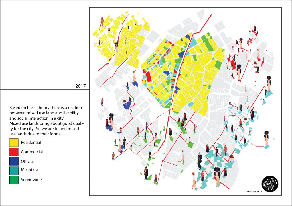
This study, that practiced part of Tehran region 1, tries to answer this question that if we look at city through form of urban blocks and lots, which urban blocks and lots are more multi-functional. Whether there is a ratio between form of urban blocks and numbers and their level of being multi-functioning. In this way we can identify which blocks and numbers(what are their form features) can bring about more social interaction.
First Stage: Checking and presence in case study place: Understanding which blocks and numbers are multi-functional – what their functions are – and in which human presence is more. Observing and shooting.
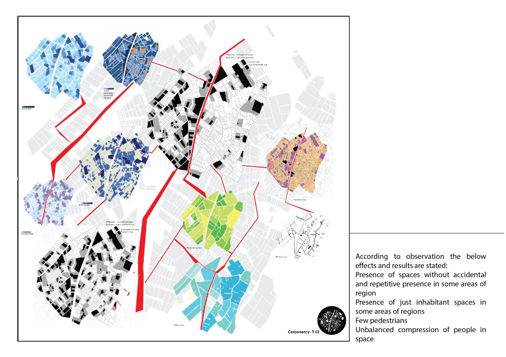
Second Stage: Extracting the ratio between multi-functional urban blocks and numbers with their forms. Producing Map A and tables as data that can determine this ratio. Using algorithm in Grasshopper plug in .
Third Stage: Matching maps with each other and understanding strategic points.
Accordingly, urban lots and blocks are categorized due to their environment, mensuration, balance, shape, width parameter of immediate path, and multi-angle. We used writing algorithms in Grasshopper plug in and produced maps containing mentioned categories. By matching these 6 categories, it can be understood that which urban blocks and numbers are multi-functional.